|
Add the Missing Tools to SketchUp Pro!
 Stop wasting your project budget on creating site context. PlaceMaker automates the creation of your site model with a simple mouse stroke!
Features Include:
- Import High resolution aerial imagery from Mapbox, Hexagon, and Nearmap
- Import Terrain from Cesium ION
- Import OpenStreetMap 3D roads, walks, paths, water, rails, and 3D building massing models
- Imagery, roads, paths, water and buildings can be imported directly onto terrain. Navigate your model using Google Street View
PlaceMaker Imports Rich 3D and 2D Models and Data Like these Examples…
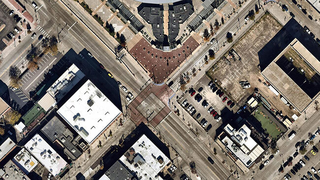
High Resolution Aerials
One of PlaceMaker’s most popular features are the High resolution aerials from Mapbox and Nearmap. Get unprecedented imagery quality for many locations around the world. Mapbox provides global coverage, with sharp imagery for most major world cities. Nearmap’s almost 3.5cm resolution and recency is a game changer for modeling and presentation.
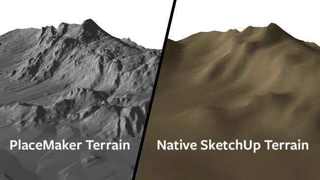
High Quality Terrain
PlaceMaker now offers access to high quality terrain from Cesium. The high quality terrain adds a new level of accuracy and granularity to terrain models. Terrain resolution varies by location. The coverage is global and the results detailed.
You can even drape aerials, 3D buildings, roads and other infrastructure onto the terrain surfaces.
3D Cities and Infrastructure
40 hours of work in 4 minutes! Quick, full of detail and easy to use, the popular PlaceMaker Extension for SketchUp lets you import 3D building massings, road and walk surfaces, high resolution aerials, trees, water and more.
It’s global data for cities and towns AROUND the WORLD.
Ai Generated Surveys
Digitizing the world with Artificial Intelligence. PlaceMaker is happy to bring you SmartSite; top of the class, next generation vector data. Using AI, SmartSite takes high-resolution aerials and transforms them into accurate site plans that include roads, walks, paths, sports fields, parking areas, bridges, highways, lawns, open spaces and much more.
Available in SketchUp and DWG (CAD) formats. Does not require the purchase of the PlaceMaker Plugin.
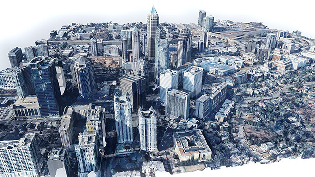
3D Mesh Cities
Google Earth’s 3D models and mesh envy no more! Created by Nearmap – high resolution 3D Mesh and Textures of Cities and Towns across the United States and Canada for a super low cost!
Available in SketchUp and FBX Formats. Does not require the purchase of the PlaceMaker plugin.
|